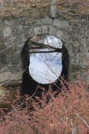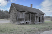
An exhibit of 20 photographs of 19th-century bridges, culverts, and other human-made structures and artifacts along the Northern Railway corridor between Concord and Lebanon is open for public viewing in the meeting room of Andover’s Town Offices building during regular business hours. Taken by Wilmot photographer Charley Freiberg in 2013, the photos were part of an historical documentation project funded by the N.H. Department of Transportation .

For the project, Freiberg and consultant Lisa Mausolf walked or biked the 69-mile rail corridor during a two-month period in 2013, checking original railroad charts, which recorded every construction detail to the hundredth of a mile. The maps hailed back to the 1800s, and were updated as bridges, culverts and other structures were added or removed.
Rail traffic along the corridor ended in the early 1970s. Constructed by the Northern Railway in 1847, the line later became part of the Boston & Maine Railroad. Passing through Andover, the line at one time served four stations: in East Andover (known as Halcyon station), Andover, Potter Place and West Andover (known as Gale station). Now a 59-mile hiking, biking and snowmobiling trail, it is operated by the N.H. Trails Bureau with support from the Friends of the Northern Rail Trail in Merrimack County, a sister organization in Grafton County, and several area snowmobile clubs. For more information, go to fnrt.org.
The exhibit was originally prepared by the Andover Historical Society and shown in the Society’s Potter Place Railroad Station in 2015. The current exhibit was facilitated by the Andover Institute, an arm of the Andover Community Association. It will be available for viewing until the end of the year.